news

CCJDC Meeting Minutes - June 20, 2024

CCJDC Agenda for Virtual Meeting
June 20, 2024
10:30am-12pm
Robert & Elayne Stein Meeting Room
Watsonville Public Library
275 Main St., Suite 100
Watsonville, CA 95076

10:33 am: Meeting called to Order
 

10:34 am: Review/Reading of Minutes


10:37 am: Additions to agenda/announcement of quarterly meeting schedule


10:40 am: Participant updates/project updates/round table announcements

  • Use GIS to map potential property/land for eco protection, conservation, easement. The homeowners benefit altruistic, or conserve land, conserve species/habitat, also get tax benefits for conservation. Most get cash influx (usually agricultural easements to buy equipment, pay mortgages) - San Benito

  • (Sandra) creating web app of properties

  • Studying EDD employment data and DMV for our regional travel demand and Activity based model.  Cleaning, manipulating, verifying, reporting data. We use GIS to map and analyze the data for whatever need we have, ranging from the ABM RTDM to analyzing the employment and land use in a certain city, but using the newest 2022-2023 2024 data so that we can develop a better updated regional travel demand and activity-based model for the coming years.


11:10 am: California Geographic Information Association (CGIA) Update

  • Chad Miller, SCS Engineers (absent)


11:20 am: Break/Networking/Refreshments (10 minutes)


11:30 am: CalBuilds Demo- Development Monitoring Tracking Tool for Jurisdictions

  • Gina Schmidt, AMBAG

  • Worked with jurisdictions for forecasted project areas, housing, type of housing, to create a long-range model for land use, employment, population, affordability, building suitability 3 counties, 18 cities

  • Automatic updating built/forecasted out with verification

  • Part of data processing was to merge by unique location b/c overlap reporting within tri-county area

  • Able to track commercial building by NAICS categories (industry, sector, etc), size and area of building, person per sqft, various metrics and data down to building level


11:45 am: GIS day sub-committee versus Technical Workshop Day discussion

  • Want to start event planning early

  • Suggestion for Technical Workshop Day instead of GIS Day for 2025, feedback?

    • Members benefitted from GIS Day in the past, but it involves a lot of coordination (students, professors), limited budget for venue/food, relies on donations, volunteers.

    • Technical Workshop would involve less work, smaller, time-commitment. Would be more GIS professionals based.

    • Technical Workshop would give flexibility in planning, we could schedule in October when people are less busy with other events.

    • Audience differentiation: GIS Day is more for students, beginners, introducing new people to GIS, Technical Workshop would be for professional development

    • Do we want CCJDC to focus on holding events for professionals (us) or new outreach? Technical workshop would be more geared towards people in the profession. Following COVID, CCJDC participation has fallen.

    • Due to uncertainty of funding/donations/volunteers, CCJDC is putting it on the agenda to create a subcommittee and depending on the level of support, we will decide either GIS Day or Technical Workshop event to begin planning.


11:55 am: Call for presenters for next meeting


12:00 pm: Wrap Up and Meeting Adjourned

CCJDC Meeting Minutes - March 20, 2024

CCJDC Agenda for Virtual Meeting
March 20, 2024
10:30am-12pm
Please join my meeting from your computer, tablet or smartphone.
https://meet.goto.com/512317389
United States: +1 (408) 650-3123
Access Code: 512-317-389
 

11:01 am: Call to Order: Meeting called to order at by Chad Miller, co-chair.

11:10 am: Review/Approval of Minutes

11:15 am: Any new announcements or additions to agenda

11:20 am:
Tribute to Aaron Cole

Chad, Charles, and Gina gave a tribute to Aaron Cole, Chair of CCJDC, who passed away.
 
11:30 am: Elections of Officers

· Chair: Charles Hanley, City of Watsonville- call meetings, set agenda & topics, get presenters

· Co-Chair: Chad Miller, SCS Engineers- co-host, leads in chair absence, set agenda & topics, get presenters

· Secretary: Gina Schmidt (AMBAG member backup)- take notes at quarterly meetings, coordinate events (technical workshop, location for events, CCJDC GIS days), gather materials

· Website Support: Renee Anchieta, County of San Benito; and Jessica Lu, AMBAG
 
11:40 am: Participant Updates

· Public works projects; working on utility network, upgrading (Charles Hanley)

· Landline replacement project, working with water department, using GPS and Maps data (Avanish Sharma)

· Updating addresses for city of Watsonville (going through old documentation) to see if there are new attributes, updating GIS data (Cassandra Tice)

· Inquiring about boundaries (schools) and how it overlaps with disadvantaged communities, opportunity to make new schools, updating air quality data (switch over to new documentation) (Eli Lessman)

· Working on updating our RTDM/ABM which is basically trip projections based on housing demographics, we are going to adopt it in June 2026, we are gearing up for modeling process next spring. Updating our base year 2022 (last was 2015). Looking at jobs, housing, roadways, working with jurisdictions to get updated data. Updating LU data, community viz based, LU model will feed into ABM. Also working on GHG model. Working on lots of GIS models but not all Esri-based (Gina Schmidt).

· MTIP, Carbon Reduction Program (Will Condon), updated Title V maps, gearing up for data validation for LU model and ABM.

· Monterey Peninsula Landfill affecting air quality in Marina, odor issues, so SCS engineers were hired to conduct an odor study, worked on mapping survey system for citizens in Marina (Chad Miller).
 
11:50 am: California Geographic Information Association (CGIA) Update

  • Chad Miller, SCS Engineers

  • California Geographic Information Association (CGIA) Update (Presentation)

    · Under CGIA Community Council (free): GIS Under the Dome

    · CGIA holds quarterly meetings, presentations on GIS topics, like subservice utilities, senate bills

    · NSGIC (National States Geographic Information Council) does Geospatial Maturity Assessment (GMA) every year. The dashboard shows grade on variables like addresses, parcels, elevation, transportation, etc.

    o GIO reports to NSGIC, our old GIO left so open position. Important for spatial data infrastructure

  • · https://cgia.org/cagiscouncil/

12:00 pm: Content Discussions
 
12:10  Wrap Up and Meeting Adjourned: Meeting adjourned by Charles Hanley

Next CCJDC meeting is tentatively scheduled for June 18, 2024.

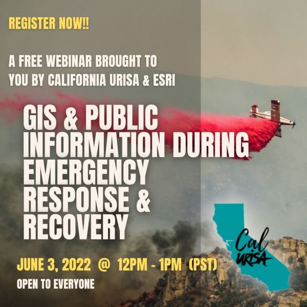
GIS & Public Information During Emergency Response & Recovery Webinar

Now open for registration! A lunchtime webinar from Cal URISA and ESRI: GIS and Public Information During Emergency Response and Recovery. More info and registration link below.

When: Jun 3, 2022 12:00 PM Pacific Time (US and Canada)

Register in advance for this meeting:

https://esri.zoom.us/meeting/register/tZ0tfuuhqjwrHNPMAkeTbGFfwO9eeaWJoeKq

After registering, you will receive a confirmation email containing information about joining the meeting.

Description

The California Chapter of the Urban Regional Information Systems Association (CalURISA) is pleased to host the Esri presented webinar: Public Information During Emergency Response and Recovery. This webinar will demonstrate the new Public Information Template for ArcGIS Experience Builder, designed to quickly deploy vital location information to the public during emergencies. The template streamlines the creation of a 3-in-1 web map application for use on devices with small, medium, and large screens. Chad Miller, GIS Analyst with the County of Monterey will host the session, with key presenters being Stephanie Baker and Jason Latoski, Solutions Engineer for Esri’s Local Government Team, along with guest presentations from Kevin Lacefield of Sonoma County and Matt Lamborn of Napa County.

Who should attend: GIS professionals, emergency response managers, and Public Information Officers working with county, city, or state government who may become involved in incident response to wildfire, flood, earthquake, and other public safety emergencies. The first part of this webinar will be geared towards the general audience, and remaining part will be a deeper dive into the workings of the Experience Builder app. There will be opportunities for audience questions and discussion, as time permits.

#GIS#gisapplication#emergencymanagement#emergencyresponse#EOC#ROC#publicsafety

CCJDC Meeting Minutes - July 20, 2021

Meeting Minutes

Tuesday July 20, 2021, 9:30 am – 12 pm

GoToMeeting Virtual Meeting

9:39 am: Call to Order: Meeting called to order by Bryan Kriete, chair of CCJDC

9:40 am: Review of Minutes

9:43 am: Any New Announcements of Additions to Agenda

9:45 am: Participant Introduction & Agency Updates

·         Bryan Kriete, County of Santa Cruz DPW

·         Chad Miller, County of Monterey

·         Patrick Dobbins, City of Gonzales

·         Jenni Gomez, County of Santa Cruz

·         Gammon Koval, Association of Monterey Bay Area Governments

·         Chris Bley, InsideUp Solutions

9:50 am: Discussion of Esri UC 2021 and EOC Activation

Gammon discussed Esri demonstrations related to Esri portals and their use with data communication.

Jenni discussed Esri demonstrations related to the Living Atlas and parcel fabric.

Chad talked about Monterey County switching to the parcel fabric from the traditional way of editing parcels within geodatabases.

Bryan discussed Esri demonstrations on the integration between AutoCAD and Esri products along with demonstrations on capital project solutions.

Group discussed if Esri UC 2022 will be in person, virtual, or both and the pros and cons of each option.

Patrick talked about Gonzales’ EOC and reliance on the county for general guidelines.

Bryan discussed the new department within the county of Santa Cruz, R3 (Response, Recovery, and Resilience), which focuses not only on emergencies but also on the recovery and preparedness.

Chad mentioned county of Monterey activated their EOC for the willow fire in June. They also set up content items to design fire evacuations and working to develop a preplanned, county-wide evacuation zone as opposed to using Zone Haven.

Bryan talked about using Zone Haven but the limitations due to its lack of integration. County worked with Esri and OES to help planners become more familiar with ArcGIS Online.

Jenni talked about CalFire working with other agencies to set up evacuation zones and trying to finalize boundaries for evacuation zones.

Bryan discussed the differences with fire and debris flow evacuation zones and the different parameters needed for each.


10:30 am: Demo

·         County of Monterey – Jupyter Notebooks

o   Chad Miller demoed using Jupyter Notebooks at a high level to create and publish a layer of lane closures from CalTrans data.


11:20 am: GIS Day Planning and Future of CCJDC

Gammon proposed keeping GIS Day online for 2021, scheduled for November.

Chad talked about keeping the CCJDC about sharing data and talked about plans to establish portal to portal sharing between Monterey County and other organizations.

Group discussed ways to continue to get more attendance at virtual meetings by sending out more frequent reminders approaching the meetings to the mailing list.

11:50 am: Wrap Up and Meeting Adjourned: Meeting adjourned by Bryan Kriete

·         Next CCJDC meeting is tentatively scheduled for September 21, 2021 with September 28 as another option.

CCJDC Meeting Minutes - October 27th, 2020

 Meeting Notes for CCJDC Virtual Meeting
October 27th, 2020

** GoToMeeting was used to facilitate this meeting**


·         Bryan Kriete, chair, called the meeting to order at 9:34 am

o   9:35 am: Review of previous meeting’s minutes. Minutes approved

·         No additions to agenda

·         Participant intros/updates

o   Bryan Kriete, GIS Analyst City of Santa Cruz Public Works

o   Gina Schmidt, GIS Coordinator for AMBAG, is working on rolling out ArcGIS Enterprise, launching mapping applications. Set up named users outside our agency for editing access to planning departments to capture local land use data for AMBAG’s long range MTP/SCS Plan.

o   Jeanette Favaloro, CSUMB, stated she is not directly involved in GIS right now, just listening in for now.

o   Will Condon, Planner at AMBAG, noted he is working on reviewing and verifying datasets for AMBAG’s travel model, and working with CARB’s EMFAC model.

o   Austin Robey, GIS Coordinator at City of Watsonville, noted that staff is very close to rolling out CityWorks for water folks. Waiting on an update which should be out next month. Using Collector and CityWorks mobile application. Also working on Enterprise. Editing geometric networks.

o   Nakul Bhatia: ESRI

o   Dario Moreno, Caltrans District 5 GIS Coordinator, Working on ATP plan for District 5. Working with SLO County for Virtual GIS day and maintenance viewer and data. Going through agreements and post modeling.

o   Joseph Londono, GIS with Caltrans District 5, working with post-models

o   Chad Miller, GIS Analyst in Information Technology Department of County of Monterey, working with ArcGIS Enterprise development, lots of ArcGIS Enterprise administration and application development.

o   Matthieu Denuelle, ESRI, Work with Caltrans, CalFire, Counties

o   Carol Ostergren, USGS, LIDAR for Central Coast funded by FEMA still not showing on National Maps, have data drives moving around. If we don’t have it yet, let her know and she will get drive to us. Santa Cruz County data on ftp site. Working closely with the state, but has no information or funding for post burn Lidar data collection. If people need assistance, can help coordinate with that. Not sure if supplemental Congressional money will exist to capture new burn data. Santa Cruz county quality level 1 collected last spring, funded by San Mateo Conservation and Santa Cruz tree people. Data processed and submitted to national maps, hopefully available soon.

§  Email: costergren@usgs.gov

§  Mail drives to 219 Appleton Drive Aptos, 95003

§  2020 QL1 Santa Cruz LiDAR: https://drive.google.com/file/d/1z-u_-1mOy0HAD6_FaABvVFG9VRRPP1mI/view?usp=sharing

§  A couple of the Santa Cruz 2020 products can be downloaded here. They could be the same ones SCC is serving. ftp://ftpext.usgs.gov/pub/wr/ca/menlo.park/costergren/

§  Austin noted he has a drive for Monterey and parts of Santa Cruz, he can share if need be. Chad Miller has hard drive for Monterey County. Both drives will be sent back to Carol ASAP.

·         9:52am: Wildfire Impacts

o   Chad Miller supported IC for the 3 fires. Made use of ArcGIS Enterprise to send up some apps quickly for evacuation zones. GIS Enterprise for post damage assessment. Evac zones were viral and crashed systems. Moved it onto ArcGIS online, want to make data center more sophisticated

o   Bryan Kriete made apps for Santa Cruz county using Survey123 to locate damaged structures, issues with parcel lines; with structures damaged it is hard to say which parcel they were on. Lost over 500 signs with PostMiles and hired contractors trying to get post miles. Using Survey123 to get signs, culverts, etc. mapped. Doing a lot of work for debris flow evacuation zones mapped. Survey123 saved them, due to cell service but haven’t implemented something that would work to collect points and then map them with devices when service resumes. San Lorenzo Valley maps are difficult with lots of unknown factors and rugged terrain.

o   Joe Londono- Caltrans having issues with parcels not lining up with imagery. Especially difficult with shadows and trees to determine property boundaries and resulting impacts of fires and trying to determine which property has structures burnt or damaged.

o   Chad Miller mentioned CalFire going to USGS for info on potential debris flows for Monterey County. Asked if Santa Cruz fire SCU? Did CalFire go and do work on Environmental Rapid Response Team report? For Dolan Fire, USFS also used USGS and BareEarth. Carmel/Salinas Fire was CalFire. CalFire was more sophisticated and got data from USGS. CalFire got report out and distribution of data. Soil burn severity was leveraged from USGS. Mass transportation evacuation plans called ZoneHaven in Santa Cruz County, and that Governor Newsom wants a statewide ZoneHaven. (Bryan mentioned that Matt Price was hesitant about ZoneHaven. Austin mentioned to take a look at services to automatically push via ArcGIS enterprise collaborations and synching).

o   Matthieu, ESRI, said statewide EOS wants statewide county data drive process for fire and evacuation mapping. He said to use Geo-Jobe to help. GeoJobe has good tools for moving content on Enterprise (https://www.geo-jobe.com/admin-tools/ )

§  Set up user accounts, move content between users in same organization, then no cost but cost associated with other actions

·         10:20 am: Nakul Bhatia presented on ArcGIS Insights Dashboard

o   Austin asked if intermediate data creates additional dataset in your datastore? Nakul replied that it does.

·         11:01 am: Dario Moreno (Caltrans) presented on Active Transportation Model and supporting dashboards

·         11:20 am: Bryan Kriete presented Santa Cruz Department of Public Works Transportation Dashboards

·         11:50 am: Dario Moreno outlined the GIS Day plan for SLO County

·         Next meeting will be in January 2021, Tuesday possibly 3rd week of month.

·         11:54 am: Meeting adjourned